6/14

Jan. 12/56 MAP
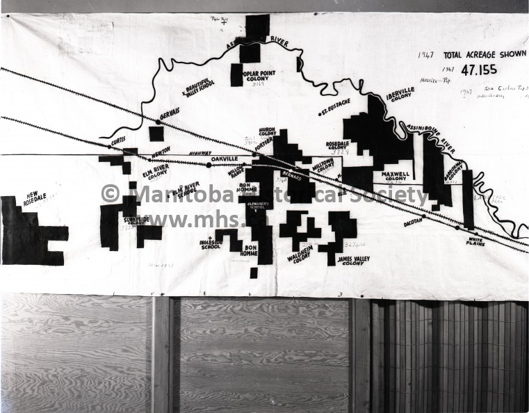
HUTTORITE COLONIES IN IMMEDIATE DISTRICTS
here is a map supplied by officials of the community welfare association of Cartier and Portage municipalities, showing the amount of land held by Huttorites. Sites such as south of Fortier, where Huttorite colonies practically surround other farmland, are places where association officials feel other farmers are being "forced out by the pincher movements" of the Huttorite expansion
- Posted on
- Tuesday 9 February 2016
- Dimensions
- 5630*4389
- File
- 11267b.jpg
- Filesize
- 2736 KB
- Albums
- Visits
- 1100
- Rating score
- no rating
- Rate this photo


0 comments